Home Holiday Homes Motorhome Park Explore Beara Gallery About Contact Call Colman directly
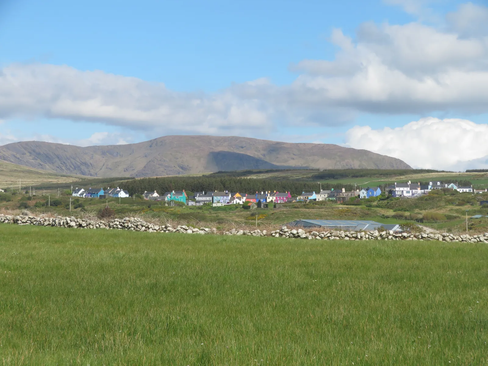
A line of brightly painted houses in Eyeries seen across a field, with the Slieve Miskish mountains behind

ExploreBeara Peninsula

Everything on Beara, from the park gate.

Two pubs and a post office two minutes away, looped coastal walks from the village shop, and the best of the Ring of Beara within an easy drive.

Eyeries sits on the north shore of the Beara Peninsula, looking out over Coulagh Bay to the mountains of Kerry. The Wild Atlantic Way and the Ring of Beara run past the village, the Beara Way walks straight through it, and the sunsets across the bay are, as the locals put it, legendary.

01

Wild Atlantic Way

The Beara coastline is part of the Wild Atlantic Way, which runs from Kinsale in the south to Malin Head in the north. Eyeries is the colourful stop on the peninsula's northern shore.

02

Ring of Beara

The driving loop around the peninsula runs just past the village on the R571. Some of the side loops are very narrow, so leave the motorhome on its pitch and go by bike or bus where you can.

03

Beara Way

A 206 km National Waymarked Trail that starts and ends in Glengarriff and passes through Eyeries, marked with yellow signposts. One stage arrives from Allihies, the next leaves for Ardgroom.

The village

Two minutes on foot

Leave the van where it is. Everything below is a short stroll from the gate.

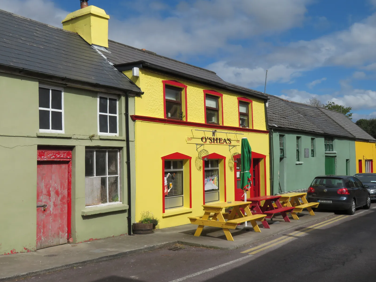
O'Shea's Bar on the main street of Eyeries, painted in bright colours
01

Pubs, shops and cafés

Eat, drink, stock up

Eyeries has two pubs, two shops (one of them the post office) and a handful of cafés, all within a couple of minutes of each other.

  • Causkey's Bar, with views out over Coulagh Bay and the Kenmare River from the patio.
  • O'Shea's Bar, the classic local, with snacks through the day.
  • O'Sullivan's Foodstore: groceries, a petrol station, a hardware store with farm supplies, and the Pink Umbrella Crafts and Gift Shop.
  • Eyeries Post Office and General Store, with refreshments as well as the post.
  • Beara Necessities Café and Wine Bar and Evie's Café.

Milleens, Ireland's first craft cheese, is made locally by the Steele family, with a farm shop for tastings.
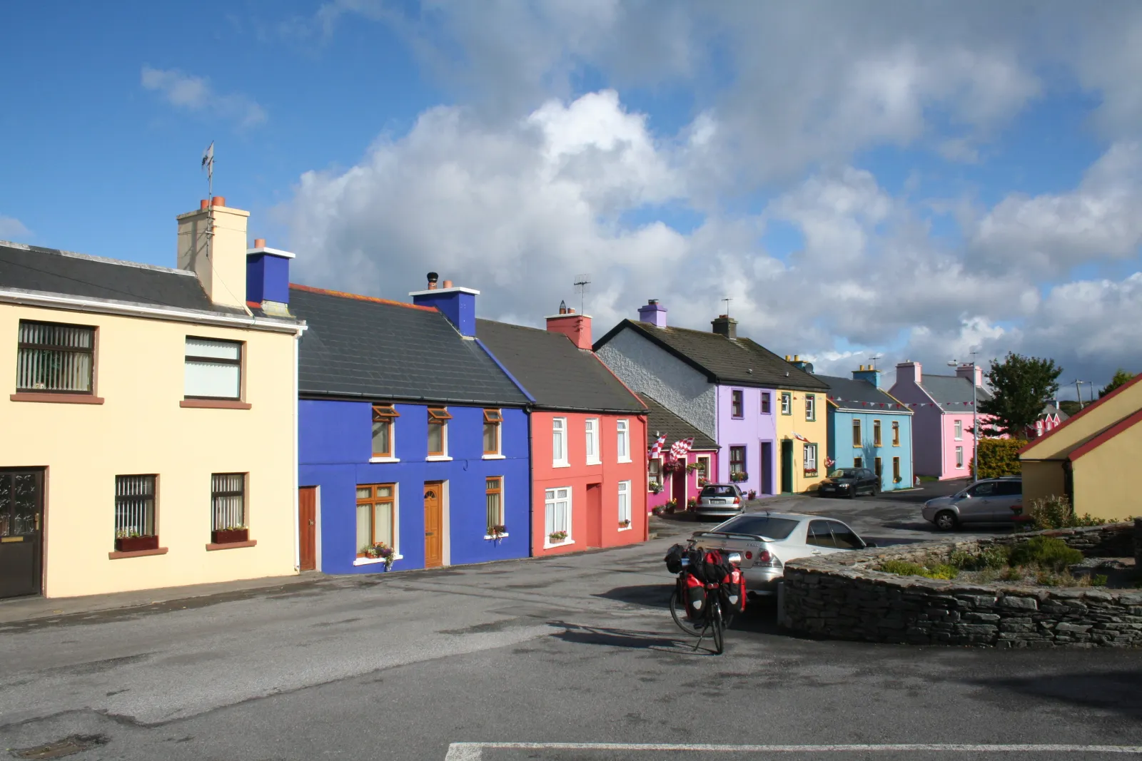
Row of brightly painted houses on the main street of Eyeries
02

A village on film

Painted houses and Tidy Towns

Eyeries was the setting for The Purple Taxi (1977), with Fred Astaire, Peter Ustinov and Charlotte Rampling, and appeared again in the 1998 series Falling for a Dancer. The painted houses line the main street today, with a flower display on nearly every window.

Eyeries Tidy Towns has been in the national competition for over 40 years, taking silver and gold medals along the way, including silver in 2024.

  • St Kentigern's Church, built 1823 to 1825, with its stained glass windows.
  • The Sensory Garden and the playground, beside the park entrance.
  • The village strand and the pier, for a swim.
  • A new Eyeries Parish Museum is under construction, due to open in summer 2027.
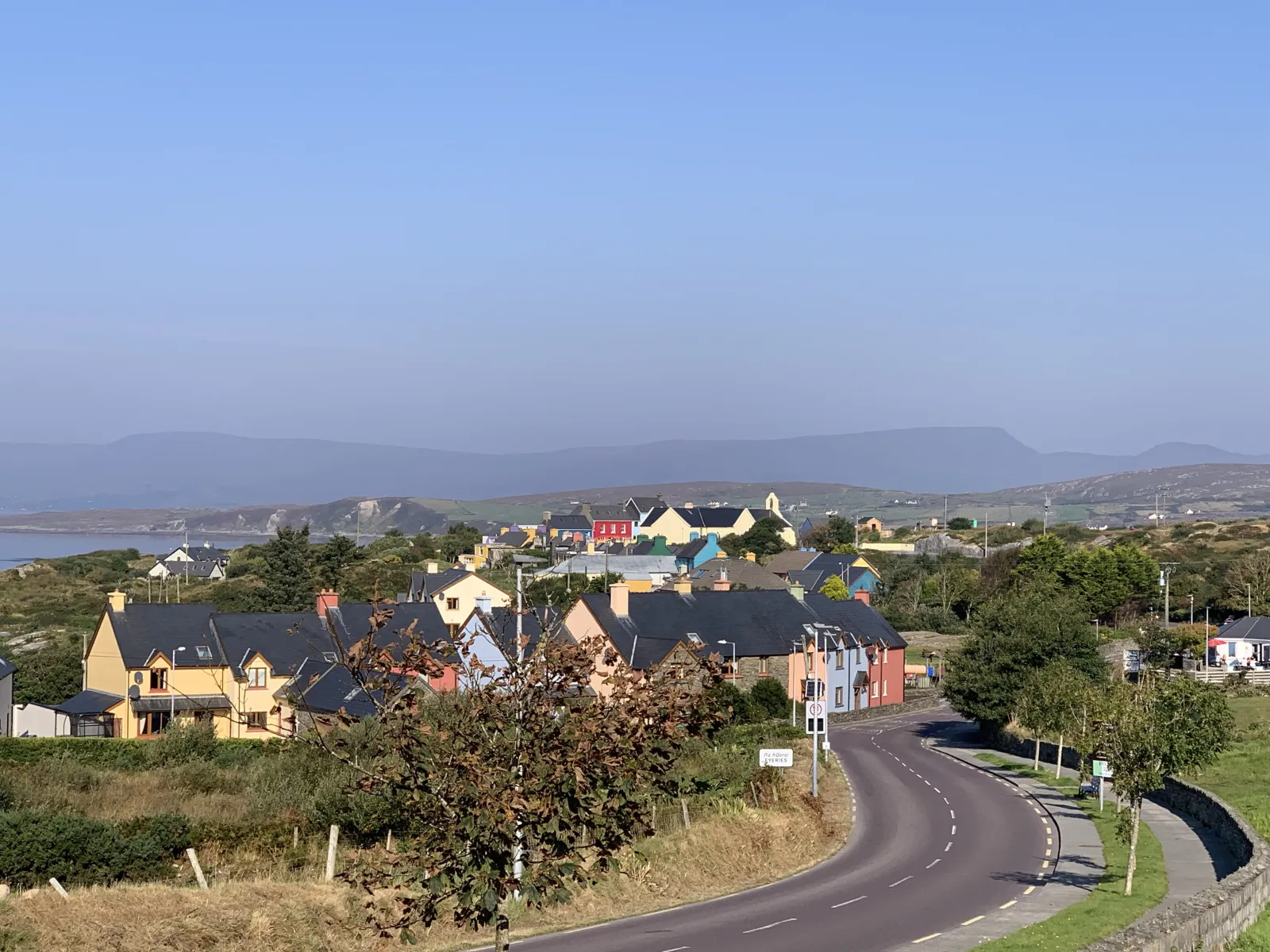
The road north into Eyeries village with the painted houses ahead
03

Eyeries Family Festival

Third weekend of July

Every July the village fills for the Eyeries Family Festival, usually on the third weekend of the month. The 2027 festival runs from 16 to 18 July. By 2019 it was drawing almost 5,000 visitors a year.

Expect music in the pubs and on the street, a Sunday market with cookery demonstrations and target road bowling, the Windows of Eyeries Art Trail in the windows of homes and businesses, digger trials, sheep dog trials, a best dressed dog show, yoga, guided walks and a Family Fun Day of games, races and face painting.

The village is busy that weekend, so get in touch early.

Festival details on eyeries.ie

Walks from the gate

Boots on at the gate

Two waymarked loops leave the village, walkable as one long circuit from O'Sullivan's store or as two shorter walks, and share stretches with the Beara Way, which passes the door. Dogs are not allowed on every section, so check before you set off with one.

Looped walk

Creha Quay Loop and Eco Walk

Starts at O'Sullivan's store, drops to the strand and follows the shore north to Creha Quay, marked with blue, yellow and red arrows. The Eco Walk follows the same loop with information boards on the birds, plants, seaweeds and marine life of the bay.

4.6 kmEasy, about 50 m of climb

Looped walk

Coastguard Station Loop

The northern loop leaves the Creha Quay road across from the Post Office and returns by the path and road from the old Coastguard Station at Gurteen, attacked by the Beara Battalion in 1920 and in ruins today, with the old boathouse and ramp still standing nearby. Walk it on its own or join it to the Creha Quay loop for one longer circuit.

From the villageStarts opposite the Post Office

Waymarked trail

The Beara Way through Eyeries

Stage 4 comes in from Allihies (16 km) and Stage 5 carries on to Ardgroom (19 km), both graded moderate. Both follow the Beara Way's yellow signposts, with views of Coulagh Bay, the Slieve Miskish mountains and, across the water, the mountains of the Ring of Kerry.

16 and 19 kmTwo moderate stages

Long distance

Beara Breifne Way

The long-distance route following O'Sullivan Beare's march of 1603 passes through Eyeries, ancestral home of the O'Sullivans. Get your walking passport stamped at the Post Office and at Causkey's Bar.

Through the villageTwo stamp points

Day trips

Out and back before sunset

Times are by car from the village. Some of the peninsula's side roads are very narrow, so where you can, leave a big motorhome on its pitch and use the local buses: the 282 calls at the village four times a day, stopping at the Beara Necessities café car park.

Heritage

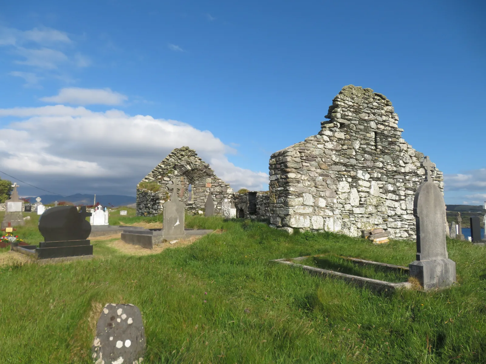
Hag of Beara and Kilcatherine Church

The ruined 7th-century church and graveyard at Kilcatherine, and a short distance beyond it the Hag of Beara, the rock said to be the goddess of winter turned to stone, forever awaiting her husband, the god of the sea.

Short drivePast Kilcatherine

Heritage

Ballycrovane Ogham Stone

At 5.3 m, the tallest ogham stone known: an older standing stone reused for its inscription, looking out over Ballycrovane Harbour.

Short driveNear Kilcatherine

Heritage

Ardgroom stone circle

A stone circle outside Ardgroom, the next village along the Beara Way from Eyeries and the end of the 19 km Stage 5 if you walk it.

Short driveTowards Kenmare

Coast

Allihies and Ballydonegan strand

The old copper-mining village, with the near-white strand at Ballydonegan below it: the sand is crushed quartz washed down from the mines over decades.

11 kmBy the coast road

Heritage

Allihies Copper Mine Museum

Tells the story of mining here from 1813, when Allihies was for a time the largest copper producer in Europe. Open 10.30 to 17.00 from Easter to mid-October, with a café and three Copper Mines Trail walks nearby.

11 kmAllihies

Coast

Dzogchen Beara

A Tibetan Buddhist retreat centre on the cliffs at Garranes, near Allihies. Visitors are welcome all year round for the café, the meditation room, a daily guided meditation and the walks through the coastal meadows and gardens.

Beara PeninsulaGarranes, Allihies

Islands

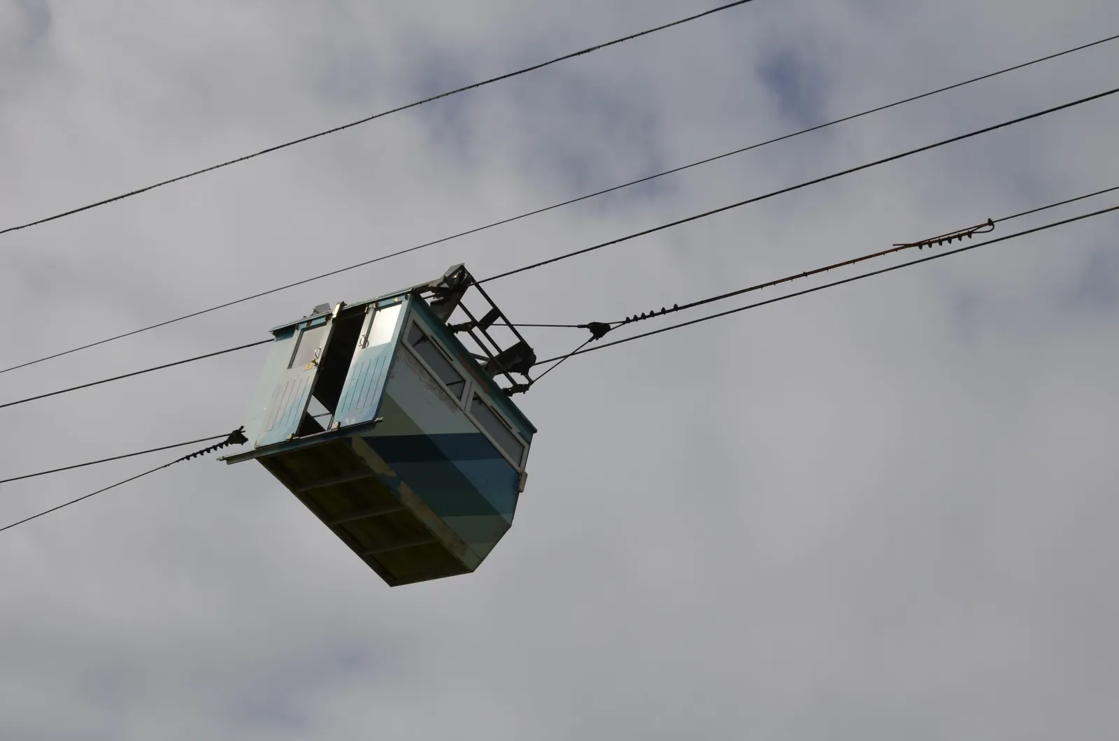
Dursey Island cable car

Ireland's only cable car crosses Dursey Sound to one of the westernmost points in the country. Cash only, first come first served, no booking, and it runs year round, weather permitting. The 263 bus runs from Castletownbere to the cable car.

Beara PeninsulaTip of the peninsula

Mountains

Healy Pass

The R574 climbs 12 km from Adrigole to Lauragh through the Caha Mountains, topping out at 334 m, with the hairpins that made it famous. Begun in 1847 as Famine relief works and renamed for Tim Healy in 1931.

Beara PeninsulaAdrigole to Lauragh

Towns

Castletownbere

Ireland's largest whitefish port, on Berehaven harbour. MacCarthy's Bar has traded since 1860 and sits on the cover of Pete McCarthy's book, and year-round car ferries cross to Bere Island in 15 to 30 minutes.

8.5 km10 min drive

Gardens

Garnish Island and Glengarriff

The OPW garden island in Glengarriff Harbour, reached by ferry from Glengarriff pier. The 2026 season runs from 20 March to 4 November, with admission paid on arrival.

Beara PeninsulaGlengarriff Harbour

Gardens

Derreen Gardens

Sixty acres of woodland garden at Lauragh with 12 km of paths, open daily all year round from 10 to 18. Café and shop from Easter to September.

20 minLauragh, Co. Kerry

Gardens

Gleninchaquin Park

A working farm and valley park on the Kerry side of Beara, with a 140 m waterfall, lakes and six marked trails. Open 10 to 17 daily, cash only.

Beara PeninsulaNear Kenmare

Towns

Kenmare

The Kerry town at the far end of the R571. If you would rather leave the van on its pitch, the 282 bus runs there from the village four times a day.

45 min41.6 km by road

Photographs of the peninsula

Beara, in pictures

The gallery has more of the village, the shore below it and the day trips on this page, from the church at Kilcatherine to the Dursey cable car.

Photographs on this page are by Gordon Hatton, Ingo Mehling, An Sasanach and K. Jähne, shared under Creative Commons licences. Full credits are on the gallery page.

See the gallery
The ruined 7th-century church and graveyard at Kilcatherine, near Eyeries The Dursey Island cable car cabin on its cables above Dursey Sound

Walk it, drive it, and be back for sunset.

Call